


We bring the traditions of cartography to the Web
Contact Us
Who we are
Axis Maps is a creative team of Web designers and developers that specializes in building interactive maps and geospatial problem-solving tools.
We have 19 years of experience partnering with clients both large and small, across the globe.
With a full range of custom geographic services, we can help put together an entire project or target specific needs. Contact us about your spatial data, visual identity, technology set up, message, and audience.
Learn MoreWe're pleased to have worked with
Recent Projects
View All Projects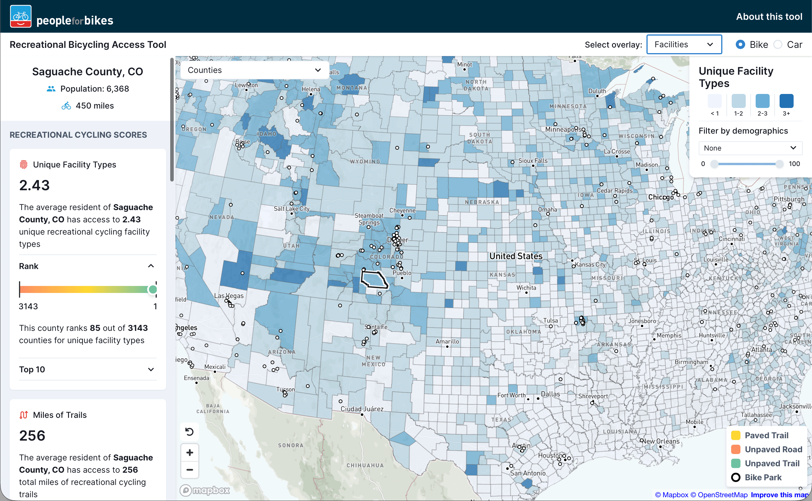
Recreational Bicycling Access Tool
A first-of-its-kind platform that quantifies access to recreational bicycling facilities across the United States to support data-driven infrastructure investments

MapMaster 3
A completely redesigned interactive mapping platform enabling students to layer thematic maps and analyze spatial patterns at regional and global scales
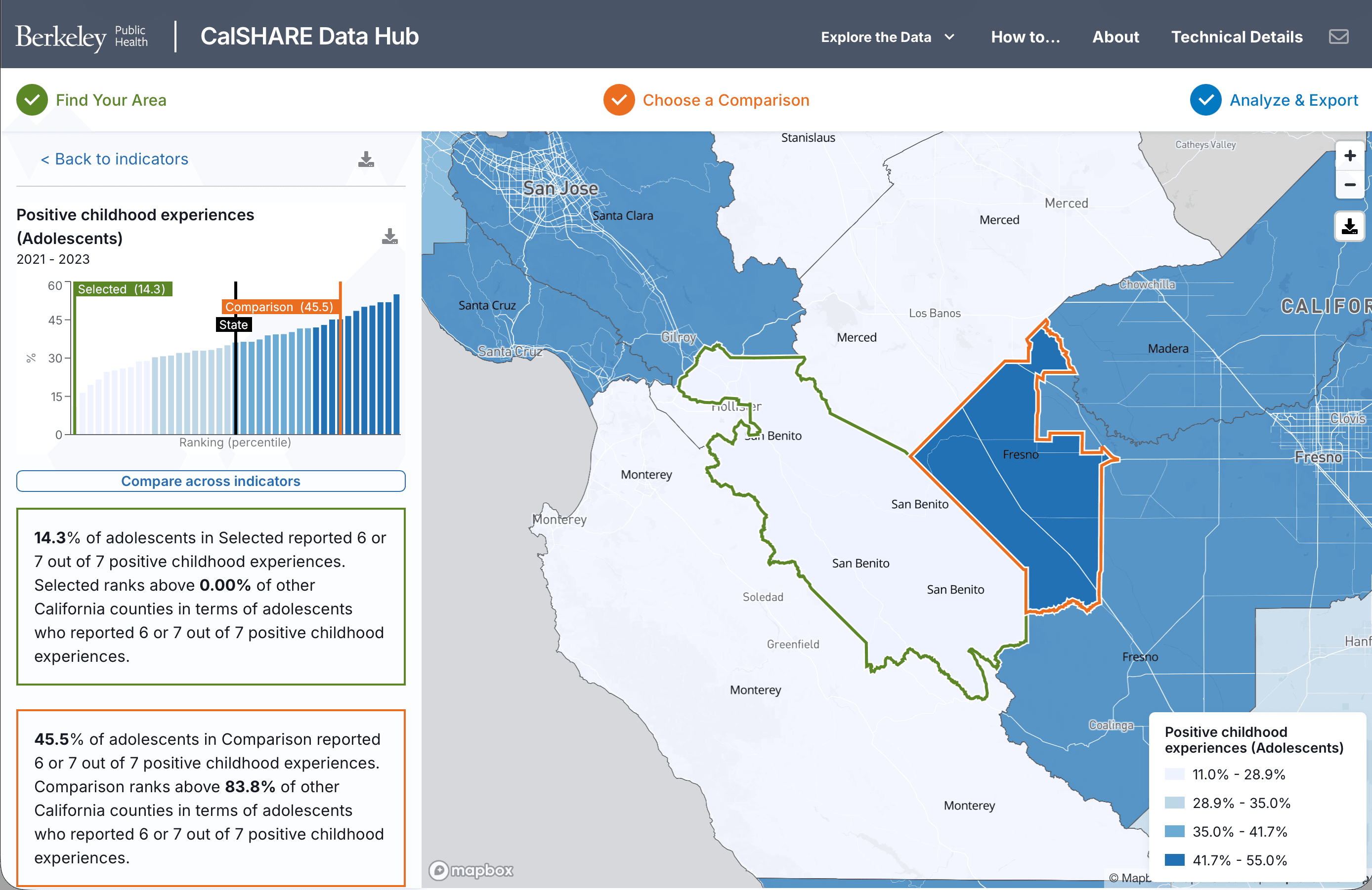
CalSHARE Data Hub
An interactive platform providing health and safety insights to understand strengths and challenges in local communities across California
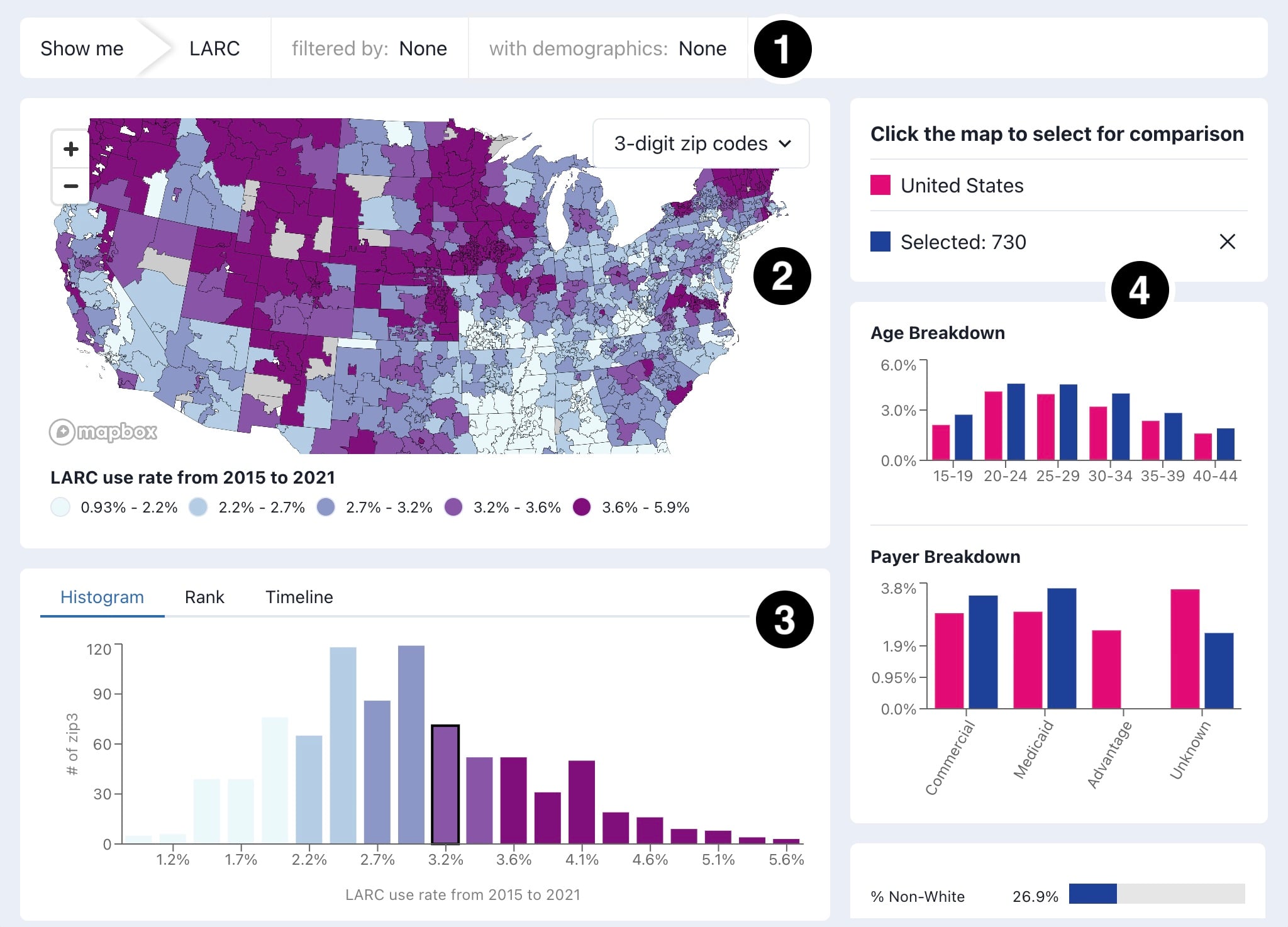
LARC Dashboard
An interactive mapping platform revealing socio-demographic and geographic disparities in LARC insertion across the United States
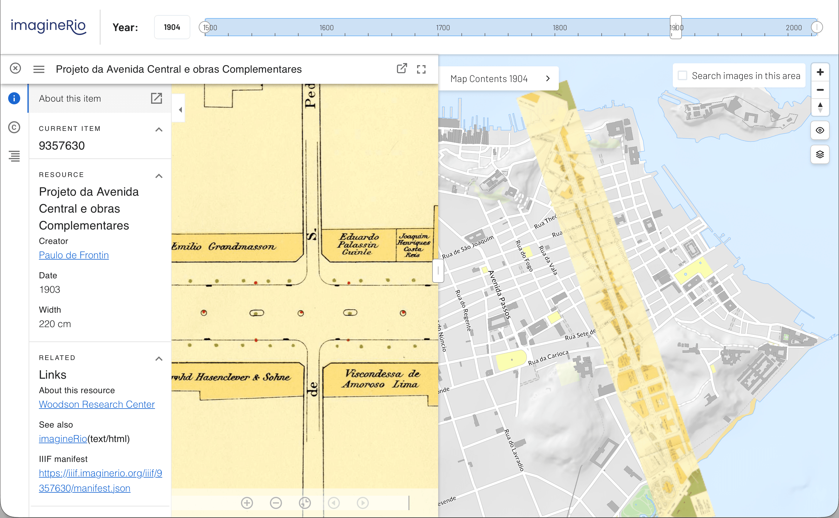
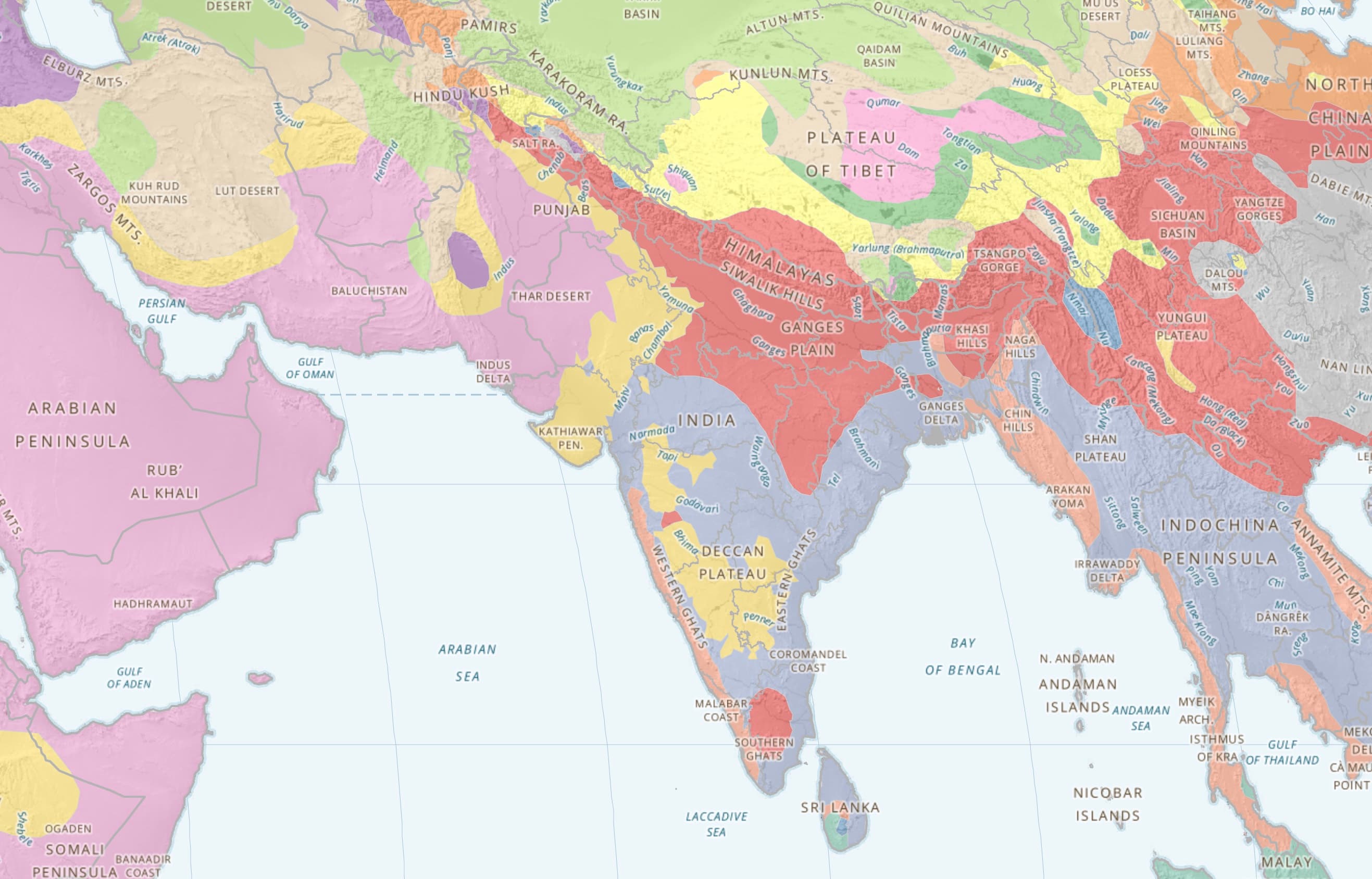
imagineRio
An interactive platform illustrating the urban and social evolution of Rio de Janeiro from 1500 to the present day through maps, views, and architectural plans
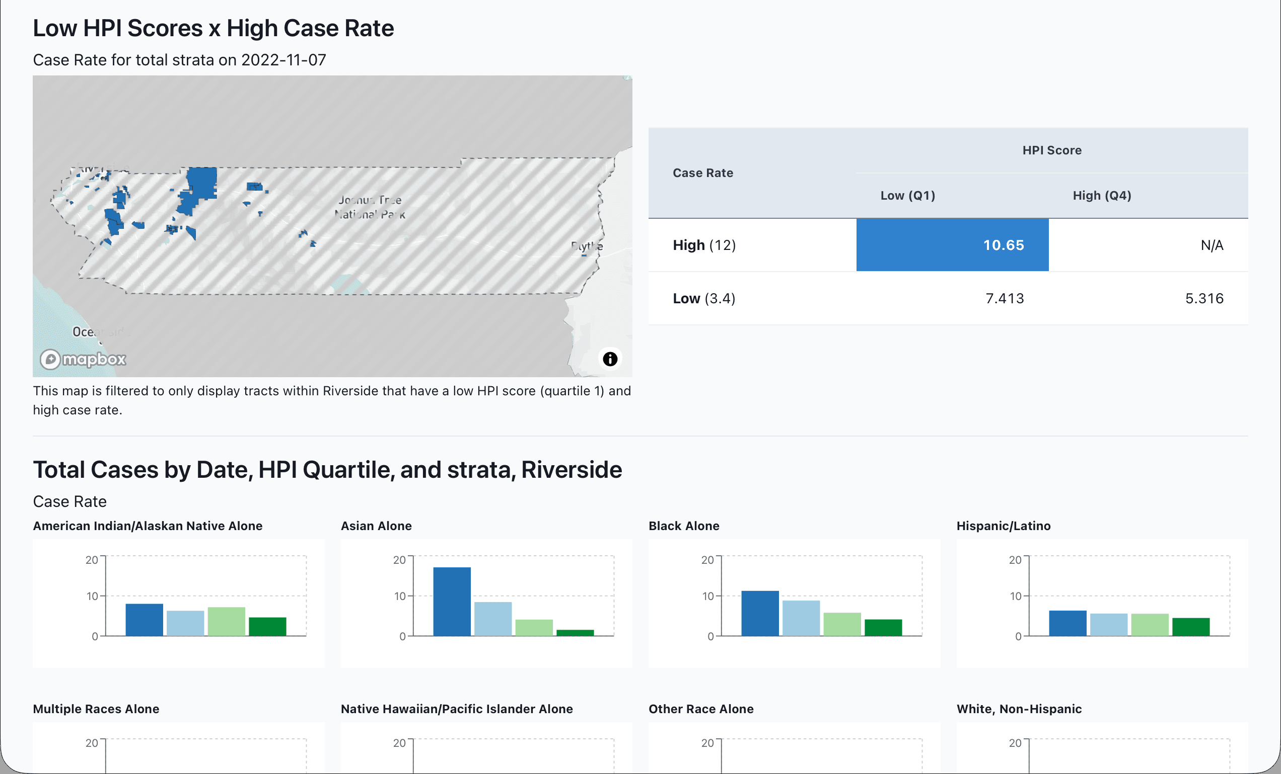
Health Equity Illuminator
A platform enabling health departments to analyze surveillance data through an equity lens by integrating health outcomes with the Healthy Places Index
How we can help
At Axis Maps, we work hard to provide thoughtful and intuitive interactive designs with every project we undertake. We want your project to look great and work as well as you do. As a small company, we are focused on efficiency, speed, quality control, and reproducible processes.
We design and deploy second versions of popular tools, modernizing the underlying technology and UI while retaining the features that existing users know.
We build maps and applications that work on a wide range of devices, from desktops to tablets and smartphones.
We design simple and elegant user-interfaces for interactive maps.
We design and build systems that automate the process of data updates and data additions.
We produce compelling cartographic visuals that communicate a wide variety of geographic information to end-users.
Resources by us, for you
Explore our collection of tools and guides designed to help you create better maps and visualizations.
Cartography Guide
A short, friendly guide to basic principles of map design. Learn important concepts in cartography and flag important decision points in map-making.
Cartography Guide →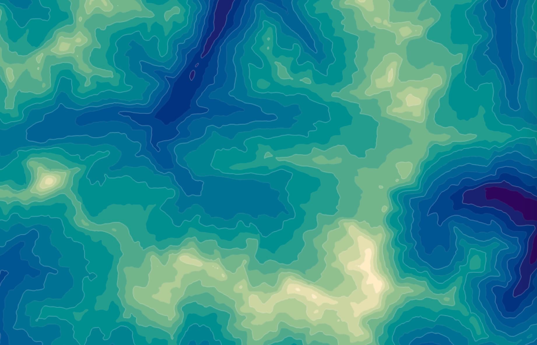
Contours
Create beautiful contour maps from your data. A modern tool for generating topographic-style visualizations for any numeric dataset.
Contours →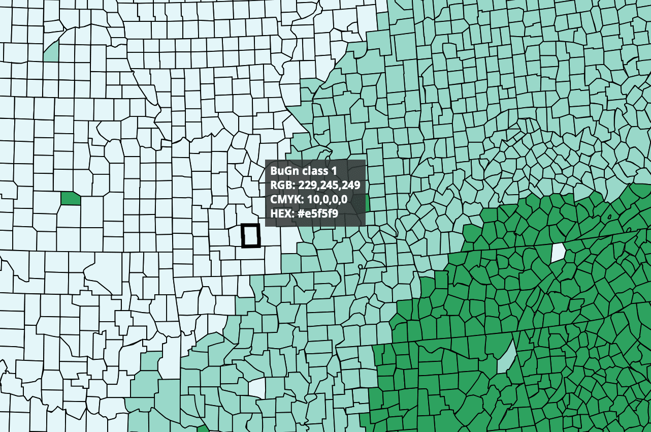
ColorBrewer
Color advice for cartography. Choose effective color schemes for your maps based on the nature of your data and your design goals.
ColorBrewer →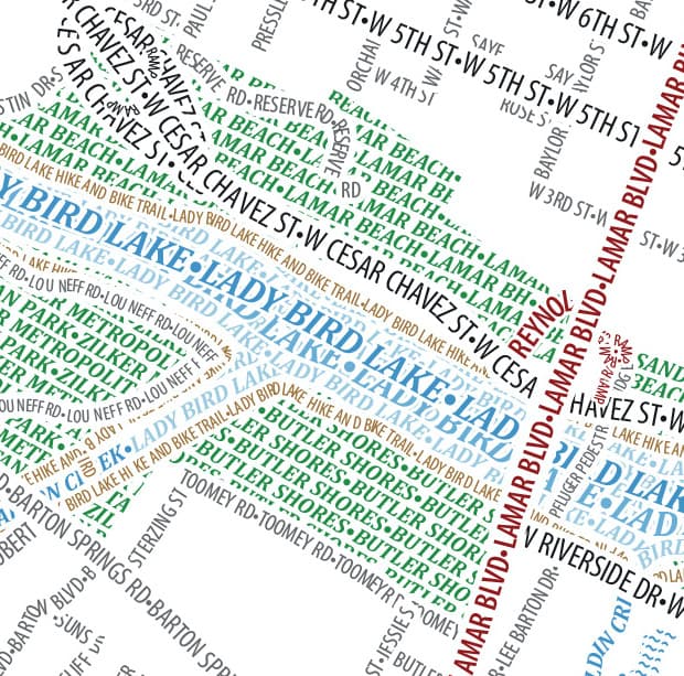
Typographic Map Store
Beautiful typographic maps of cities around the world. Each map is composed entirely of text labels, creating a unique visualization of place names.
Typographic Map Store →