Imagining the Israeli-Palestinian Border
Client: Washington Institute for Near East Policy
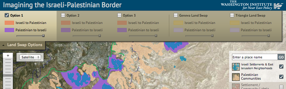
In conjunction with The Washington Institute for Near East Policy's Imagining the Border project, this map was developed to allow users to explore different Israeli / Palestinian land swap proposals. Complicated linework is loaded dynamically via KML and users can customize the display by adjusting the transparency of each option. Extensive settlement / community data is searchable by name to locate individual settlements in a large dataset.